GA5000
GA5000
Contact Us for Price
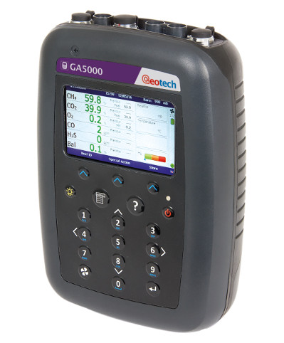
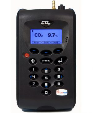
The GA5000 is an ATEX certified portable gas analyser for the landfill gas market. Easy to use and calibrate, the GA5000 benefits from our market leading reliability and helping you to standardise monitoring routines, whilst supporting environmental legislation compliance.
About Geotech’s portable landfill gas analyser
- The GA5000 is built for the landfill gas market and measures critical gases within landfill applications: % CH4, CO2 and O2
- Additional gases include H2S (up to 10000ppm), NH3, H2 and CO (H2 compensated)
- Safe, reliable and repeatable results: ATEX, IECEx, MCERTS, CSA and UKAS calibration (ISO17025) certified
- Measures accuracy of +/-0.5% after calibration for CH4 and CO2 (+/- 1% O2)
- Modular and upgradeable: add or remove cells, measure flow
- On board context-sensitive help to guide you through every step of using the analyser
- Optional Gas Analyser Manager Software (GAM) for ID set up and data download
- Increased functionality with a range of accessories available including ATEX certified anemometer
- Designed and manufactured in the UK
Benefits
- Supports environmental legislation compliance
- ATEX certification provides an intrinsically safe guarantee when used in potentially explosive atmospheres
- Market leading quality, reliability and accuracy
- Provides you with traceability and trends of key gas data through its supporting software
- Hassle free analysis: the menu guides you through the gas analysis process; calibration takes less than 3 minutes
- The GA5000 takes on the analysis for you: set your IDs, their order and it standardises your monitoring routines
GPS / field navigator
- Accurate information from Geotech’s GPS system about the route taken in the gas field
- Clear and informative instructions about distances of well head measurement points on site
- Easy to use and navigate
- Enables you to plan your next gas monitoring route
- 3-axis compass: exact latitude, longitude and altitude ensures accuracy
- Clear display of current location and next or nearest bore hole ID
- 2000 IDs location store with multiple site on just one analyser
- Google Earth mapping system (via GAM software)
Categories: Gas Detection, Portable Gas Detectors, Landfill Gas.

